


UNION EAST Voting District, Fayette County, Ohio
About
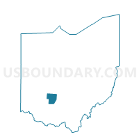
Outline

Summary
| Unique Area Identifier | 645695 |
| Name | UNION EAST Voting District |
| County | Fayette County |
| State | Ohio |
| Area (square miles) | 11.92 |
| Land Area (square miles) | 11.92 |
| Water Area (square miles) | 0.00 |
| % of Land Area | 100.00 |
| % of Water Area | 0.00 |
| Latitude of the Internal Point | 39.56968420 |
| Longtitude of the Internal Point | -83.39177510 |
Maps


Graphs
Select a template below for downloading or customizing gragh for UNION EAST Voting District, Fayette County, Ohio


Neighbors
Neighoring Voting District (by Name) Neighboring Voting District on the Map
- BLOOMINGBURG Voting District, Fayette County, OH
- MARION Voting District, Fayette County, OH
- PAINT Voting District, Fayette County, OH
- UNION NORTH Voting District, Fayette County, OH
- UNION SOUTH/WEST Voting District, Fayette County, OH
- WASHINGTON 1B Voting District, Fayette County, OH
- WASHINGTON 1C Voting District, Fayette County, OH
- WASHINGTON 4A Voting District, Fayette County, OH
- WASHINGTON 4C Voting District, Fayette County, OH
- WAYNE Voting District, Fayette County, OH
Top 10 Neighboring County Subdivision (by Population) Neighboring County Subdivision on the Map
- Washington Court House city, Fayette County, OH (14,192)
- Union township, Fayette County, OH (3,733)
- Paint township, Fayette County, OH (1,975)
- Wayne township, Fayette County, OH (1,387)
- Marion township, Fayette County, OH (766)
Top 10 Neighboring Place (by Population) Neighboring Place on the Map
Top 10 Neighboring Unified School District (by Population) Neighboring Unified School District on the Map
- Miami Trace Local School District, OH (15,618)
- Washington Court House City School District, OH (13,861)
Top 10 Neighboring State Legislative District Lower Chamber (by Population) Neighboring State Legislative District Lower Chamber on the Map
Top 10 Neighboring State Legislative District Upper Chamber (by Population) Neighboring State Legislative District Upper Chamber on the Map
Top 10 Neighboring 111th Congressional District (by Population) Neighboring 111th Congressional District on the Map
Top 10 Neighboring Census Tract (by Population) Neighboring Census Tract on the Map
- Census Tract 9261, Fayette County, OH (4,772)
- Census Tract 9262, Fayette County, OH (4,692)
- Census Tract 9264, Fayette County, OH (4,324)
- Census Tract 9258, Fayette County, OH (3,976)